Dewar students put themselves on the map
Published 11:00 am Thursday, March 24, 2022
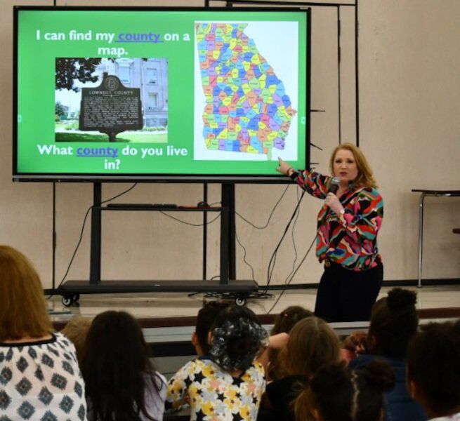
- Submitted Photo Lowndes County Manager Paige Dukes shows Dewar Elementary first graders where Lowndes County is on a map.
VALDOSTA – City of Valdosta and Lowndes County officials recently visited Dewar Elementary School to help first graders better understand their community and the importance of maps.
Guest speakers included Lowndes County Manager Paige Dukes; J.D. Dillard, director of planning & zoning, and Valdosta Mayor Scott James Matheson, county officials said in a statement.
Dillard began the presentation by inquiring how familiar the audience was with maps and showcased a map he made of the county.
First-grade student Meredith Sebring said, “It was interesting to learn about how they make maps.”
The map highlighted the location of each Lowndes County elementary school and even showed the proximity to local favorites including Wild Adventures Theme Park and Moody Air Force Base.
“The map showed how big our county is,” said Parker Umpleby, first grader. Parker and his classmates liked seeing how Lowndes County is next to many other counties on the map of Georgia.
The map was white with yellow spots. The colored spots represented the city limits for Valdosta, Hahira, Lake Park, Remerton and Dasher, all cities in Lowndes County. Dukes said related these city “spots” within the county to pepperoni on a pizza, which sparked the interest of the students.
Matheson spoke on behalf of the City of Valdosta, home to half of Lowndes County’s population. He discussed his role as an elected official and how many people it takes to make things happen that they may take for granted, like, “making sure your toilet flushes and your lights turn on.”
The three reinforced the importance of locating themselves on a map in case of an emergency.
“Who likes fire trucks?” Dukes asked. Every hand in the room was raised. She explained that if they had to dial 911, they have to be able to say where they are to receive help. The firetrucks would then use maps like Dillard showed to find their way to the emergency.
Carris Fener, first grader, said the presentation was “kind they answered so many questions.”
Students went back to class proud that they can now locate themselves on a map.


